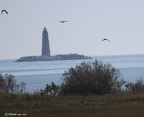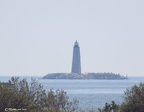
 20161019 1494 1
0 comments
1410 hits 20161019 1499-1
0 comments
1288 hits 20161019 1506-5
0 comments
1274 hits 20161019 1508-1
0 comments
1262 hits 20161019 1512 1
0 comments
1688 hits 20241029 9274 5 5
0 comments
379 hits 20241029 9279 6 6
0 comments
342 hits 20241029 9282 7 7
0 comments
340 hits 20241029 9284 8 8
0 comments
356 hits 20241029 9306 9 9
0 comments
365 hits 20241029 9331 10 10
0 comments
422 hits
Location New Point Comfort at the entrance to MobJack Bay in the Chesapeake Bay
Coordinates : 37.3006°N 76.2775°W
Year first constructed: 1805
Year first lit: 1806
Automated :1930
Deactivated :1963-1999
Construction : sandstone masonry
Tower shape :Octagonal tower
Height: 58 feet (18 m)
Original lens: fourth-order Fresnel lens
Current lens : 9.8 inches (250 mm) API
Range :13 miles (21 km)
Characteristic :Fixed white
I visited this lighthouse on Oct 19 2016 and again on October 29 2024. The lighthouse sits 0.6 of a mile offshore and the day was very hazy.
The lighthouse is visible from the board walk at the end of the preserve.
The lighthouse is owned by the County of Matthews. Tower closed.
Added to the National Register of Historic Places on March 1 1973
Access: Car + long Lens or boat